Autoloader
Autoloader is a application developed to automate the installation of Tracks, Waypoints, POI's, and Map images to the internal memory of a Garmin GPS. The installation is fairly straightforward and easy:
1. Prepare the GPS. If you are installing GPX files, you may wish to clear existing tracks and waypoints to make more room.
2. Create a folder somewhere on the PC hard drive, or attached DVD, Thumb Drive, Floppy Disk, or SD card and copy the Autoload15.exe program in it.
3. Copy files to be transferred into the same directory with the program.
These file types are supported:
POI files (.gpi extension)
Waypoint and Track files (.gpx extension)
Map Image files (.img extension)
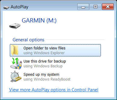
4. Connect the GPS via a USB cable. You may have to wait a short time while the GPS installs on your PC. The PC should eventually recognize the device. If your GPS prompts you for it, you want it to be recognized as a USB storage device. (You may not be prompted) If you get a Autorun dialogue on the PC then you are definitely ready to go. The appearance of this varies somewhat with different versions of windows. This is from Windows 7:
5. Don't respond to the Autoplay Options, just click the red cross and close the dialogue.
6. Run the Autoload15 program by double clicking on it. A DOS box will
open on the screen.
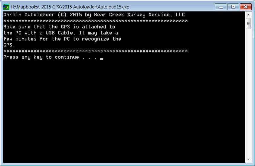
Press a key to continue.
The program will locate the GPS if it is installed correctly. If it is not, you will get an error at this point and you should go back to step 1.
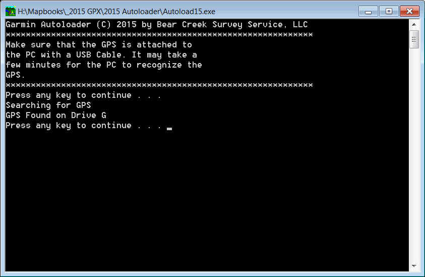
7. Press a key to continue:

Installation may take a few minutes on some receivers, so wait for the "Press any key to continue..." prompt. When it is displayed, the files are installed.
8. Disconnect the GPS and test to make sure that the files you installed are working.
Where to find and use data on the GPS:
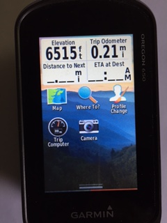
Tracks can be viewed and assigned colors in "Track Manager". (A Garmin peculiarity - the Tracks prompt is used to navigate to a track, but not to configure it.) These pictures are all from a Garmin Oregon 650, but the prompts are similar for other models.
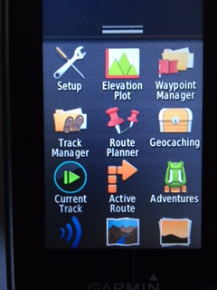
The different data types are accessible via the "Where To" Icon, which looks like magnifying glass. This is used to navigate to a feature.
POI's are viewed in "Extras". They will NOT be accessed
under the "All POIs" or "Waypoints"
menus. (The correct Garmin icon looks like a wrapped present on
most recently marketed units)
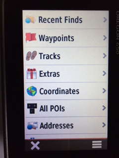
Selecting "Extras" brings you to a listing of all the installed POI data divided by states.
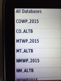
The POI databases are further subdivided between the official route and the alternates. The COWP_2015 file pictured above is official trail, the CO_ALTB is the alternates. Clicking on one of these data sets will bring you to a Waypoint List
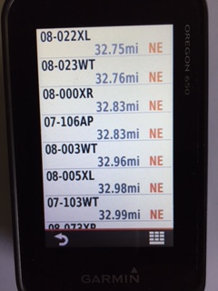
The Waypoints are listed by proximity - the closest one to your GPS location is at the top of the list. Selecting a Waypoint will take you to this screen:
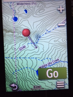
Select "Go" to navigate to the waypoint.
To purchase the Autoloader program either as a stand alone installer for your own files, or with all the Track and Waypoint files needed to navigate click here: