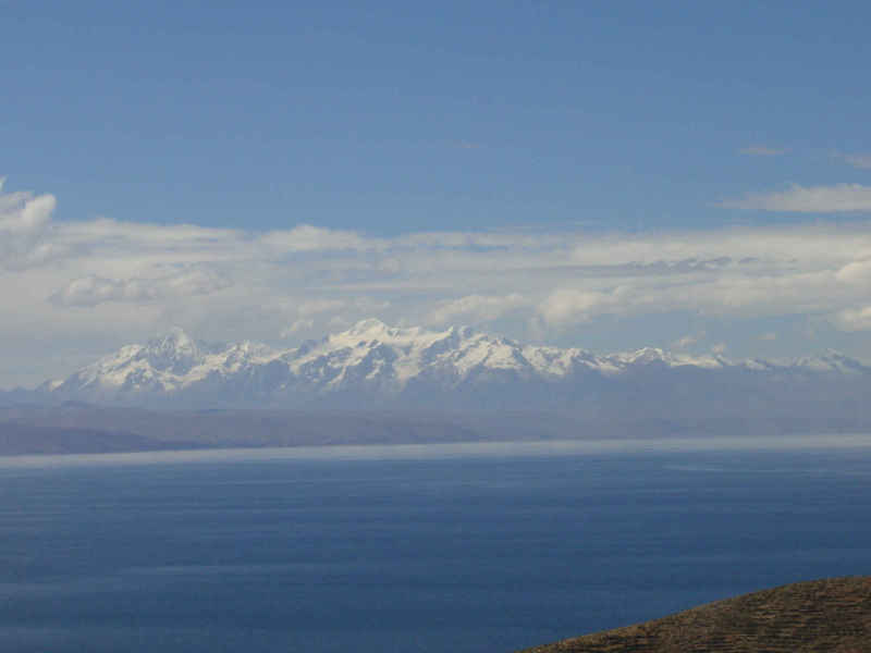
 Ancohuma from Lake Titikaka
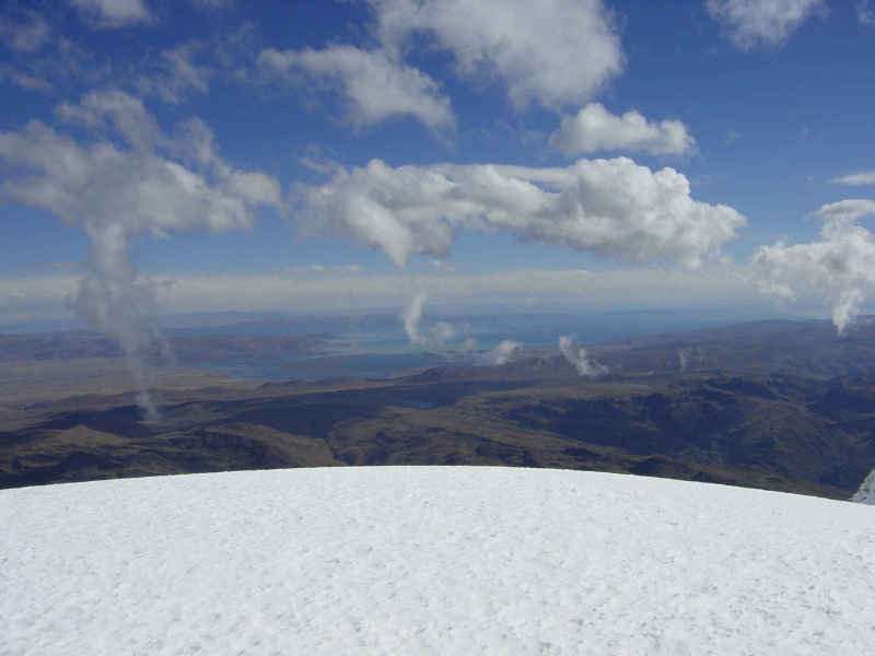 Lake Titikaka from Ancohuma
 Ancohuma Mapping Expedition 2002
Ancohuma from Lake Titikaka
Lake Titikaka from Ancohuma
Anchouma Photo Gallery (follow this link to lots of great photos)
In 1928, a German-Austrian expedition went to Bolivia to study glacerized mountains. The group was led by geographer Carl Troll, and they combined field photography with triangulation to determine the locations and altitudes of many of the high peaks of the Bolivian Andes. His observations placed the altitude of Ancohuma at 6,427 meters. (21,085 feet) Troll's values came into dispute in the early 1990's after the altitude was re-calculated on the basis of satellite based aero-triangulation and then reported in "The Times World Atlas" as 7012 meters. This value would make the peak the highest in the western hemisphere, and the numerous climbers of the "Seven Summits" would have to return to South America if the peak turned out to be higher than Argentina's Aconcagua. (6,961 meters or 22,841 feet) Several attempts were made to resolve the issue using GPS technology. One attempt by Dennis Moore was thwarted by equipment failure in 1995 and another by the British Royal Survey was stopped by difficult conditions on the mountain. In 2000 Bear Creek was approached by David Appleton, who runs an adventure travel and mountaineering service called Outpost Wilderness Adventures . Appleton's company had already made several expeditionary climbs in the Bolivian Andes. The companies teamed up, with Bear Creek providing technical mapping and GPS expertise and OWA arranging everything else. Trimble navigation donated the use of two Pathfinder Pro XRS GPS receivers and the Omnistar Corporation provided a free subscription to it's South American differential correction service which communicates with ground units via private satellite. Dr. Kenneth Adnam and RN Holly Gryzckowski of Breckenridge, Colorado, experts in altitude related illnesses also joined the team. They brought medical supplies including a Gamow Bag, used to treat altitude sickness. (see photo gallery) Accomplished mountaineer Chris Haaland joined as cinematographer, with plans to film a movie of the trip. OWA provided guides Peter Merlin, Quentin Keith, and Paul Johnson. Johnson is the veteran of many climbs in the Andes.
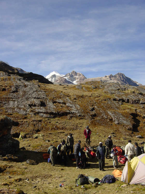 Illampu Massif from first camp at 14,500 feet.
The climb was unique because many of it's climbers were so young. Despite their youthful ages, most had participated in OWA programs in the past, and had substantial mountaineering experience.
The American group of 6 adults and 12 teenagers left the USA for Bolivia on June 24, 2002. They were joined by 6 Bolivians to make the total size of the expedition 24 people. The group landed at the La Paz, Bolivia airport (4,114 meters - 13,500 feet) After a day in LaPaz, they traveled to Cococabana on Lake Titikaka to begin the process of altitude acclimatization and begin instruction on the use of the GPS equipment. The group climbed a small peak near the town, then trekked the length of the island Isla del Sol. (3,810 meters - 12,500 feet) The group then traveled to the Refugio hut (4,730 meters - 15,518 feet) located at the base camp of popular peak Huayna Potosi. A week was spent at the camp practicing ice and snow climbing on nearby glaciers. The last day at the camp, the group climbed the peak Charkini and established it's altitude using GPS at 5,379 meters (17,648 feet).
 Trimble unit on summit of Charkini
Next the group traveled to Sorata, (2,683 meters - 8,802 feet) a small village near the base of the Illampu Massif, of which Ancohuma is the highest peak. On July 6, the group began the long hike in light rain towards the peak. It was snowing hard on the peak itself. The first camp was made by a small lake at 4,420 meters (14,500 feet) elevation. The second day the group established a base camp at the foot of the Laguna Glacier at 4,900 meters (16,076 feet.) The following day a high camp was established on the glacier at 5500 meters (18, 045 feet) The high camp was pounded incessantly by strong winds. The group awakened at 2AM and began climbing by 2:30 in the darkness. Great care had to be exercised to avoid crevasses on the glacier. As the group gained altitude, they encountered deep snow. Two people turned back due to altitude illness. The remaining teams took turns breaking the deep snow until the steep ice pitches began just above 6,100 meters (20, 000 feet). The combination of deep snow, 60 MPH winds, and sub zero temperatures began to have an effect. A rope team of people with potential cold injuries turned back at 6250 meters (20,500'). The remaining climbers pushed on, with a single team of four climbers reaching the summit at about 10AM. They quickly set up the GPS gear on the summit and recorded data for about 11 minutes. (653 differentially corrected records) All teams then retreated from the peak to avoid further possibilities of injuries due to the extreme conditions. Back at the base camp, the data was downloaded to a laptop computer and the new elevation of Ancohuma was calculated as 6,425 meters or 21,079 feet. The Trimble software predicted a possible accuracy range of +,- .6 meters (2 feet). The data proves that the triangulation made in 1928 was incredibly accurate.
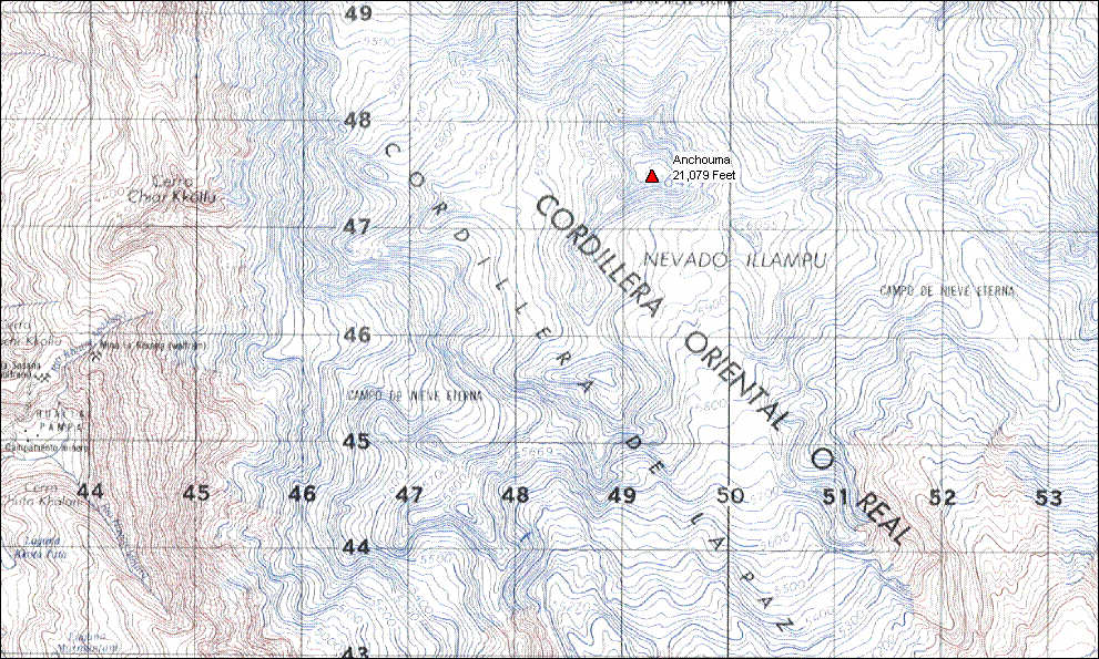 Click on image to show a topographic map image of the summit (from Bolivian
government maps).
Click on image to show a topographic map image of the summit (from Bolivian
government maps).
PRESS RELEASE FROM BOLIVIA - July 10, 2002
Sorata, Bolivia – The American and Bolivian climbing expedition that set out to map and determine the exact elevation of Bolivian Andes Ancohuma has succeeded. Using Trimble GPS receivers and Omnistar differential GPS service, four of the twenty three member expedition stood on top of Ancohuma and collected data for approximately 10 minutes confirming the elevation to be 6425 meters (21,079 feet). Despite unusually bad weather, including heavy snowfall and high winds, the team hauled the nearly 30 pounds of GPS equipment to the summit and succeeded where others have failed.
Michael Sproul (15) of Durango, Co, Elliot White (19) of Denver, Co, Christian Dean (19) of Dallas, Tx with Bolivian Guide Lorenzo Lima (31) climbed to the top the summit at around 10:15 am on July 8, 2002. Other members of the party reached a high ridge within a few hundred feet of the summit but were thwarted by very cold temperatures and 60+ mile/hour winds. Paul Johnson, co-leader of the expedition, said, "we climbed the 70 degree headwall to the ridge and I thought we might get a break form the wind to hit the summit. But it was too much for us and I made the call to descend." Johnson’s team carried the other of the two GPS receivers.
Quentin Keith, the other American leader of the trip, said, "It’s pretty amazing that we able to pull this off. It’s the hardest and most draining trip I’ve led in 11 years of guiding." Starting in Sorata, Bolivia at 8700 feet, the expedition spent 2 days toiling up to a base camp of 16,600 feet, another day to establish a high camp at 18,000 feet. They summit on the 4th day and descended the nearly 8000 feet back to Sorata on the 5th day. Bolivian Guide service operator, Dr. Hugo Berrios, hired the 18 porters, cooks and supplied 3 of the 6 guides for the mountain.
The expedition was the brain child of David Appleton, owner of Outpost Wilderness Adventure in Colorado, an adventure guiding program specializing in teen adventure. Together with Colorado Trail cartographer, Jerry Brown of Bear Creek Survey Service, Inc., Appleton assembled the group and worked up the logistics. Appleton’s goal was to confirm once and for all the exact height of Ancohuma, which many maps showed to be around 7000 meters, perhaps making it the highest peak in the western hemisphere and tallest in South America. "We have been guiding in Bolivia for 6 or 7 years and I thought it would be pretty remarkable to get a group of teenagers to do the work of "GPSing" the summit.
Of his role in the group, Brown said, "I was there to teach the kids how to use the GPS receivers and as a kind of technical support. These guys picked it up so fast and operated it perfectly on the summit. That would have been a task for the most experienced operator and mountaineer and these kids did it. It was impressive to see."
Two British teams attempted the same task in 1995 and 2000. The 1995 attempt, led by Dennis Moore, failed because of equipment problems and the 2000 attempt, sponsored by the Royal British Engineers, failed to summit due to harsh conditions.
One member of the team, Guide Brett Merlin, suffered moderate frostbite on his hand and feet but otherwise the team experienced few setbacks. Merlin was treated by team physician Ken Adnam of Breckenridge, Colorado. Of Merlin’s injury, Adnan stated that "he (Merlin) should recover completely without much long-term damage."
Home